United Kingdom
Software that empowers and protects
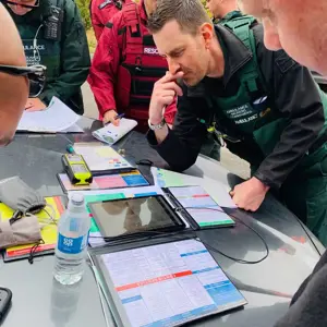
Our mapping technology and software is trusted by law enforcement, military, special forces, search & rescue, fire and medical emergency services globally.
Airbox produces the most comprehensive suite of situational awareness tools available anywhere on both desktop PCs and mobile platforms. Designed for planning, execution and after action review, Airbox software is trusted by law enforcement, military, special forces, search & rescue, fire and medical emergency services. With over 400 maps available to use and the option to create your own, the base level map can sit off-line allowing operations to continue whilst no internet access is available.
Improving safety outcomes
We aim to protect life through enabling informed decisions
 >21%
Overall increased strategic confidence
>21%
Overall increased strategic confidence
 +24%
Resource management for ground tasking
+24%
Resource management for ground tasking
 <38%
Response times are productively reduced
<38%
Response times are productively reduced

Multi-platform, multi device

Maps and Charts

Schematics and Overlays

Annotation

Tracking

E-Logging

Live Video and Sensors

Navigation


